Click here to zoom out to the map of western Canada
There are two topo maps of the Cirque produced by the Geological Survey of Canada.
| Map Name | Sheet Number |
Scale | Contour Interval |
Comments |
|---|---|---|---|---|
| Glacier Lake | 95L | 1:250,000 | 200m | The scale is too large for the Cirque (the whole thing fits in a 1"x1" postage stamp area). This map is probably only useful if you are navigating the Nahanni. |
| Mount Sir James MacBrien | 95L/4 | 1:50,000 | 20m | This is the best topo map available of the Cirque (it fits in a 6"x6" square). |
You can view digitized maps and order paper maps or digital data from the Center for Topographic Information.
Paper copies of maps can be obtained from Natural Resources Canada.
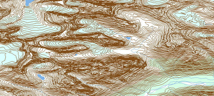
The region of 95L/4 containing the cirque is shown below (two versions):
|
|
What you will see on the
Center for Topographic Information
web site (squashed vertically, for some reason).
© Her Majesty the Queen in Right of Canada, Department of Natural Resources. All rights reserved. |
|
|
|
The above image forced half as wide, so that the NS and EW scales are now equal (compare to paper map below). © Her Majesty the Queen in Right of Canada, Department of Natural Resources. All rights reserved. |
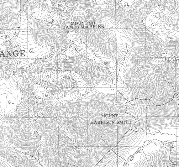
|
|
A scan of the paper map 95L/4 (squares are 1 km on a side, contour interval 20m).
© Her Majesty the Queen in Right of Canada, Department of Natural Resources. All rights reserved. |
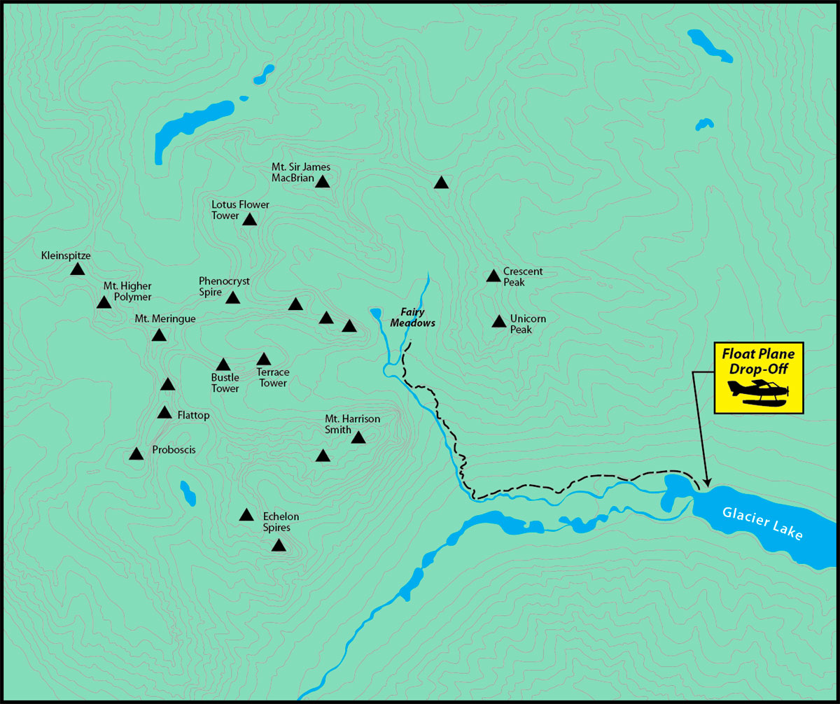
 Main Cirque Index