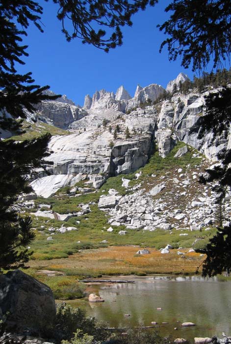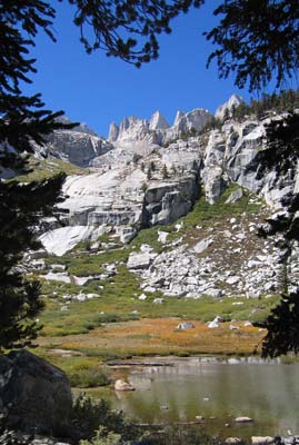
Whitney from Lower Boy Scout Lake
(summit on the right)
|
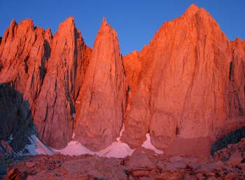
The East Face of Mt. Whitney
By Warren Teissier
(warra@comcast.net)
Photos by George Bell
(gibell@comcast.net)
Written September 2005; Climb date 9/19/2005
[Click on any image for the full size version]
|
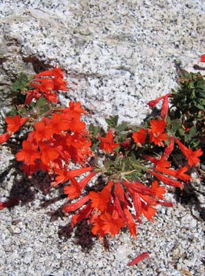
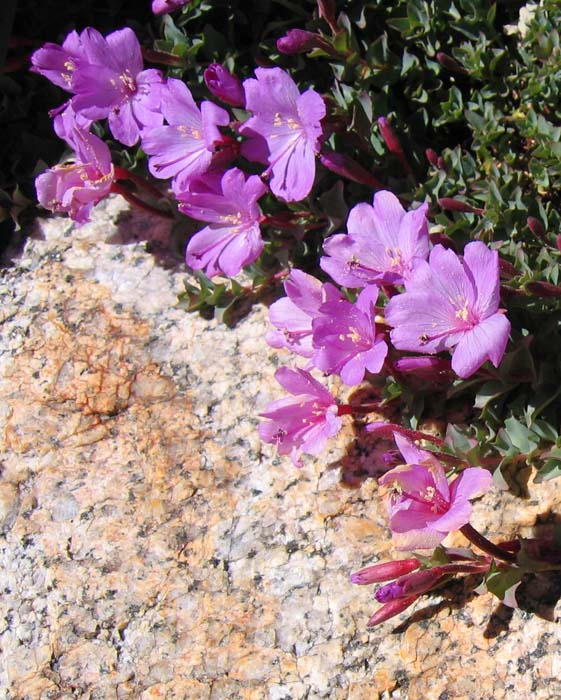
California Fuchsia on the Ebersbacher Ledges
|
Climbing with George Bell is hard.
Not that he is tough to get along with or that he doesn't carry his weight on the outings,
on the contrary.
I mean this in the sense that he has been at it for so long and so avidly that
there are few things I propose climbing that he hasn't done ...

|
Rock Fringe (Rose Epilobium) below Iceberg Lake
Copyright © 2005 by
George I. Bell
|
So, I was really surprised when I found out he had not climbed the East face of Mt Whitney.
I don't think he is clear as to why he had, so far, ignored this particular
50 "Crowded Climb" as he calls them.
But after nagging him about it for a couple of years he finally acquiesced.
Six months to the day of the climb George was tasked with calling the ranger station
to get a camping permit.
He tried this for two week ends in a row until he was finally successful.
We got a permit to camp the night of Sept. 18th and 19th.
We figured we would do Whitney on 19th and scramble up Russell on the 20th.
We determined Vegas was the most economical/closest place to fly to and after
renting a car we drove through Death valley towards the town of Lone Pine.
As I scanned the radio, half an hour out of Vegas,
we appropriately dialed into "Highway to Hell" from AC/DC.
And so, we head-banged our way to the Mt Whitney portal.
We were delighted to find camping spots at the portal and we quickly struck
a conversation with a couple of Scots camped next to us.
Paul and Paul from Glasgow were planning on climbing the same mountains
on the same dates, with the exception that they were looking at climbing
the Mountaineer's route.
We quickly decided to stick together where appropriate ...
We left the portal at the non-alpine time of 9:30AM the next day,
with enough beta to fill a backpack: from Gary's NACLASSICS to Supertopo
and other multiple sources including "local beta" that the Scots got
from the owner of the portal (who also sold them a book he wrote with even more beta).
George and I stayed at Lower Boy Scout Lake while the Scots headed for Iceberg Lake.
We wanted to carry our packs the least amount of vertical possible and to be able to
get a decent night sleep, they wanted to spend the night above 12K ft and have more
time to sleep in the morning. Trade offs I guess ...
|
The East Face of the Whitney Massif at dawn.
Copyright © 2005 by
George I. Bell
|
We spend the rest of the afternoon setting up camp and scouting the approach
to the beginning of the route.
While at Iceberg lake, we heard that an accident had occurred near the
bottom of the Mountaineers route (a woman fell and suffered a compound
fracture on one of her legs) this triggered a flurry of activity and
the rest of the afternoon was filled with the sounds of choppers ferrying
S&R folks and gear and eventually extracting her a little before dark.
With full bellies we laid down on perfect granite slabs and gazed at the sky at dusk.
We marveled at the mare's tail clouds and saw the stars appear one at a time as the
last of the sun's rays disappeared.
We then witnessed a large full moon light up the white granite canyon walls.
The stage was set for the climb of the East Face.
It was supposed to be cold, "25 degrees in the morning" they had told us,
so we decided to allow for about an hour of sunlight on the wall before we
started climbing.
It turned out to be warmer than advertised but a cool breeze throughout
the day had me wearing 3 layers for most of the climb.
As we put on our harnesses and shoes at the start of the tower traverse
we heard some voices to our right and I spied a climber on the
East Buttress route, sternly addressing his partner above him with "MORE SLACK!".
I thought they were going up, but as we later found out,
they had gotten benighted on the first pitch of the route!
I guess this mountain attracts climbers of all levels of competency ...

|
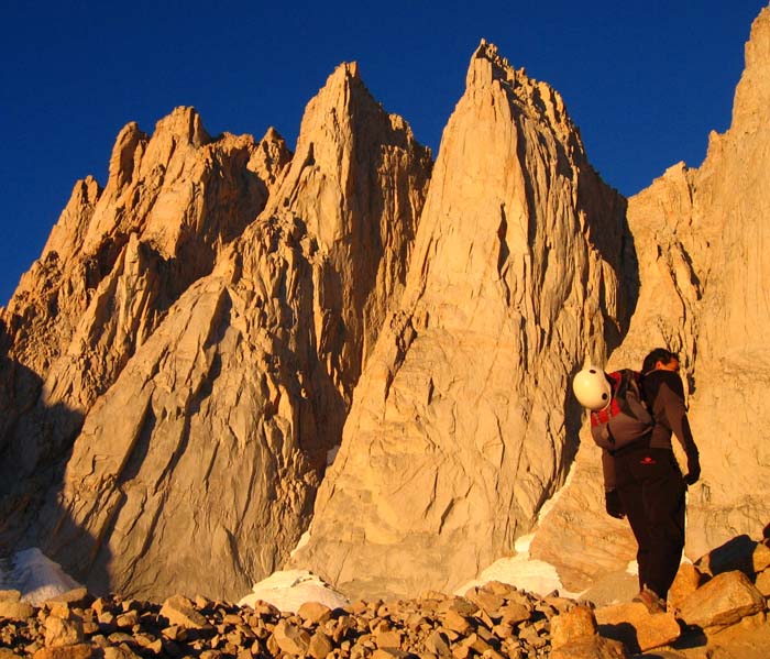
Day Needle and Keeler Needle.
Copyright © 2005 by
George I. Bell
|
I drew the lead of the Tower traverse.
It is unsettling to go from a large ledge with no exposure to a slanting
half-foot ledge with 1000 ft of exposure and minimal roundy hand holds in one step.
And the pro? Well let's just say it was not as much as I would have liked ...
After this, George led us up as we simul-climbed the Washboard pitches.
From there I lead us up the 5.7 (thinking it was the 5.6) variation of
the small headwall leading to the notch before the down climb to the ledge
below the Fresh Air traverse.
After resetting our belay for the lead of the Fresh Air we stopped to have
some lunch and water.
The weather was California perfect: crisp air, cool breeze and sunny.
Not a single cloud in the sky.
|
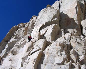
George leading the Fresh Air Traverse.
Copyright © 2005 by
George I. Bell
|
After lunch George lead the Fresh Air pitch.
This pitch is nothing short of spectacular and the short section
of unprotected face climbing after the traverse added an unexpected amount
of excitement to the process.
He then led the chimney pitch that leads to the Grand Staircase.
The pitch looked harder and loser than it actually proved to be
and much to our delight no chimney moves were required.
We then switched over and I lead the first pitch of the Grand Staircase.
We found the lose rock quite unnerving since we had a party behind us and
we were worried the rope would knock rocks down onto them.
After some cautious scrambling and astute rope management we regrouped
and I led the last pitch of the Staircase.
This pitch included an awkward 5.7 bulge with a pin and the stout
off-width dihedral finish
(which we both agreed was the hardest pitch of the day).
|
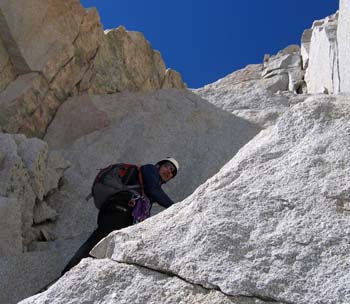
Warren on the Grand Staircase, starting the crux pitch.
Copyright © 2005 by
George I. Bell
|
After the last pitch of the Grand Staircase we began to feel the altitude.
True to my style, I started to bonk since I had not eaten as much as I should have.
The last three pitches were easy, but we were definitely not moving as fast as
we were three hours earlier. We summited 4 hours after starting the climb.
We had climbed 4,200 vertical ft from our campground at lower Boy Scout lake.
At the summit we met up with the Scots and proceeded down the Mountaineers route.
While at the summit we heard there was a change in the weather forecast.
A cold front was moving in, the forecast for the next day called for 30% chance
of thunderstorms. This was mentioned to us with real concern.
George and I couldn't help but smirk at this.
In Colorado the forecast never calls for anything LESS than 30% chance of T-storms ...
And so it was that at midnight, the sudden burst of rain forced George,
who was sleeping outside, into the tent...
By six am, the rain made us cancel the climb of Mt Russell.
By 8 am, still raining and with water leaking into the tent
we decided we needed to get out of there.
To our amazement upon exiting the tent we saw snow at the 12,000 ft level
and severe cloud cover.
I guess we were on the wrong end of the 30% forecast...
But this was no thunderstorm, this was a large low pressure system socking us in...
We hiked down waterfalls that formed on the Ebersbacher Ledges and after the
Scots bought us hot coffee at the Portal and we had burgers in Lone Pine
we left for Vegas.
|
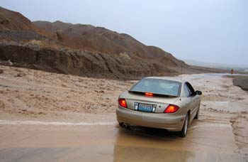
Tempting fate trying to get to the lowest point in the US
Copyright © 2005 by
George I. Bell
|
With time on our hands we decided to visit the lowest point in the USA,
which happens to be within Death Valley.
After all, we had just been to the highest (in the lower 48) and we
figured this would bring completion to our trip.
We drove through the storm and I could not help but notice that on
the radio Chris Rea was singing "The Road to Hell" coincidence?
I think not!
We arrived in Death valley two hours later, still raining.
The dry lakes had water, and the washes had blasted onto the
road pushing dirt and rocks.
This was not a very common Death Valley experience...
We headed past the visitor center and towards the lowest point,
some 30 vertical feet lower than where we were, but 17 miles away from us.
I drove past ever worsening creeks and then rivers that crossed the road,
some displacing rocks large enough that I could not have cleared them under the car.
Finally we reached a wash (coming off Zabriskie point) that looked to be
two feet deep and very fast.
I had a vision of us being stuck in the wash, sitting atop our car,
water to the windshield, shivering as a chopper tried to pluck us out.
The thought of us appearing in the evening with a story line of
"the stupid climbers, tried to drive through a swollen river in their
rental and had to be rescued by the Inyo County Sheriff's department.
They were not wearing their helmets" struck the fear of God in us and
we both felt that 30ft was close enough to the lowest point.
We left well enough alone and pointed the car towards Vegas.
|
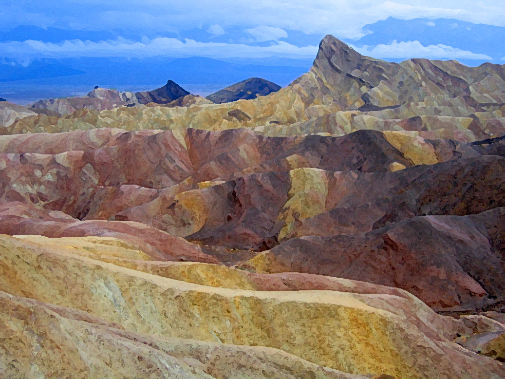
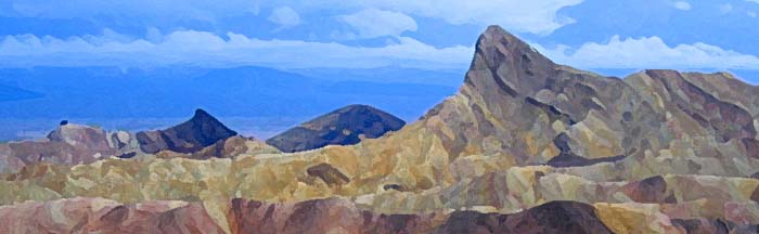
The view from Zabriskie Point immediately after a rainstorm.
Copyright © 2005 by
George I. Bell
|
 Trip Report Index ...